Overview
The Pat Harrison Waterway District in cooperation with the George County Board of Supervisors (applicant), has applied for a Department of the Army Permit for the construction of two proposed water supply lakes to be located north of Wade, Mississippi, in both George and Jackson County, Mississippi.
The Applicant is proposing to place fill into jurisdictional wetlands and streams for the purpose of constructing two earthen dams to create two lakes. The proposed project includes:
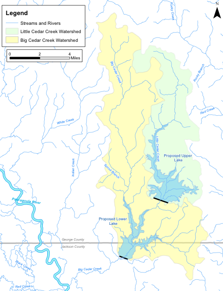
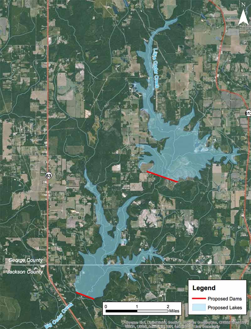
- A proposed upper dam located on Little Cedar Creek east of Clarence Bonnett Road to create a 1,715-acre lake with a storage capacity of 31,410 acre-feet
- A proposed lower dam located on Big Cedar Creek below the confluence with Little Cedar Creek to create a 1,153-acre lake with a storage capacity of 20,228 acre-feet
The Applicant has identified the below potential approximate impacts to waters in the vicinity of the projects:
- 1,200 acres of wetlands,
- 42 miles of stream channels, and
- 25 acres of open water
The U.S. Army Corps of Engineers Mobile District is reviewing this application (SAM-2014-00653-MBM) and is processing it pursuant to Section 404 of the Clean Water Act which regulates the discharge of dredged or fill material into waters of the United States. To fully evaluate the Applicant’s proposal, an Environmental Impact Statement (EIS) will be prepared to determine the effects of the proposal on the human and natural environment.
Purpose & Need
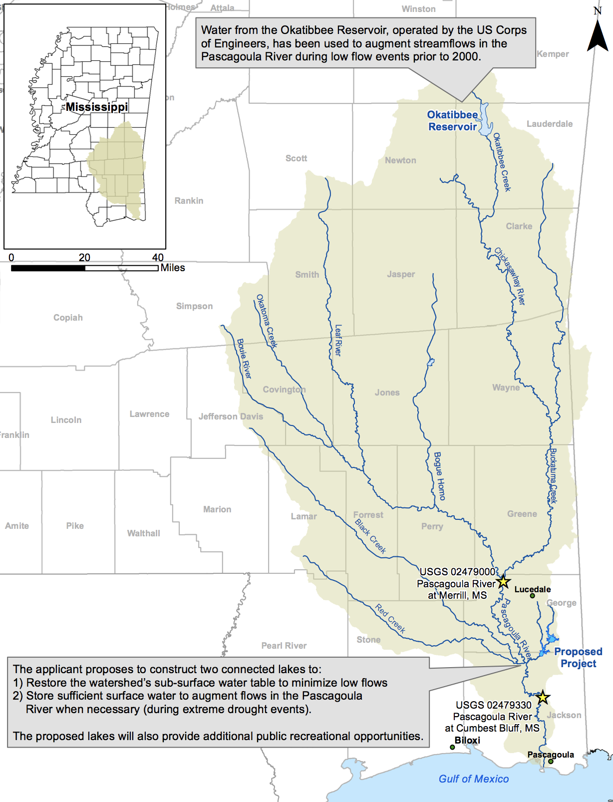
The applicant’s stated purpose for the two connected lakes is to store water to serve as a secondary water source to sustain the Pascagoula River at the target minimum flow of 917 cubic feet per second (CFS), as measured at the U.S. Geological Survey gage 02479000 (Pascagoula River at Merrill, Mississippi). The applicant stated that maintaining the minimum 7Q10 flow (the lowest 7-day average flow that occurs on average once every 10 years) is necessary for the river to meet critical environmental, ecological, and economic needs through 2060.
The applicant stated that the proposed project provides a two-pronged drought resiliency approach:
- 1) to restore the watershed’s sub-surface water table to minimize low flows;
- 2) to store sufficient surface water supplies to augment flows in the Pascagoula River when necessary.
Flows from the lakes would be released during extreme prolonged drought conditions, which are projected to occur more frequently in the future, with higher intensity and longer duration, due to climate change.
In addition to its primary drought resiliency purpose, the project includes public recreational facilities which will be operated and maintained by the Pat Harrison Waterway District.
Proposed Lakes
Proposed Lakes Aerial
Applicant’s Purpose and Need
 Cowerts Branch south of Bismark Road – area would be flooded by the proposed Lower Lake on Big Cedar Creek Cowerts Branch south of Bismark Road – area would be flooded by the proposed Lower Lake on Big Cedar Creek |
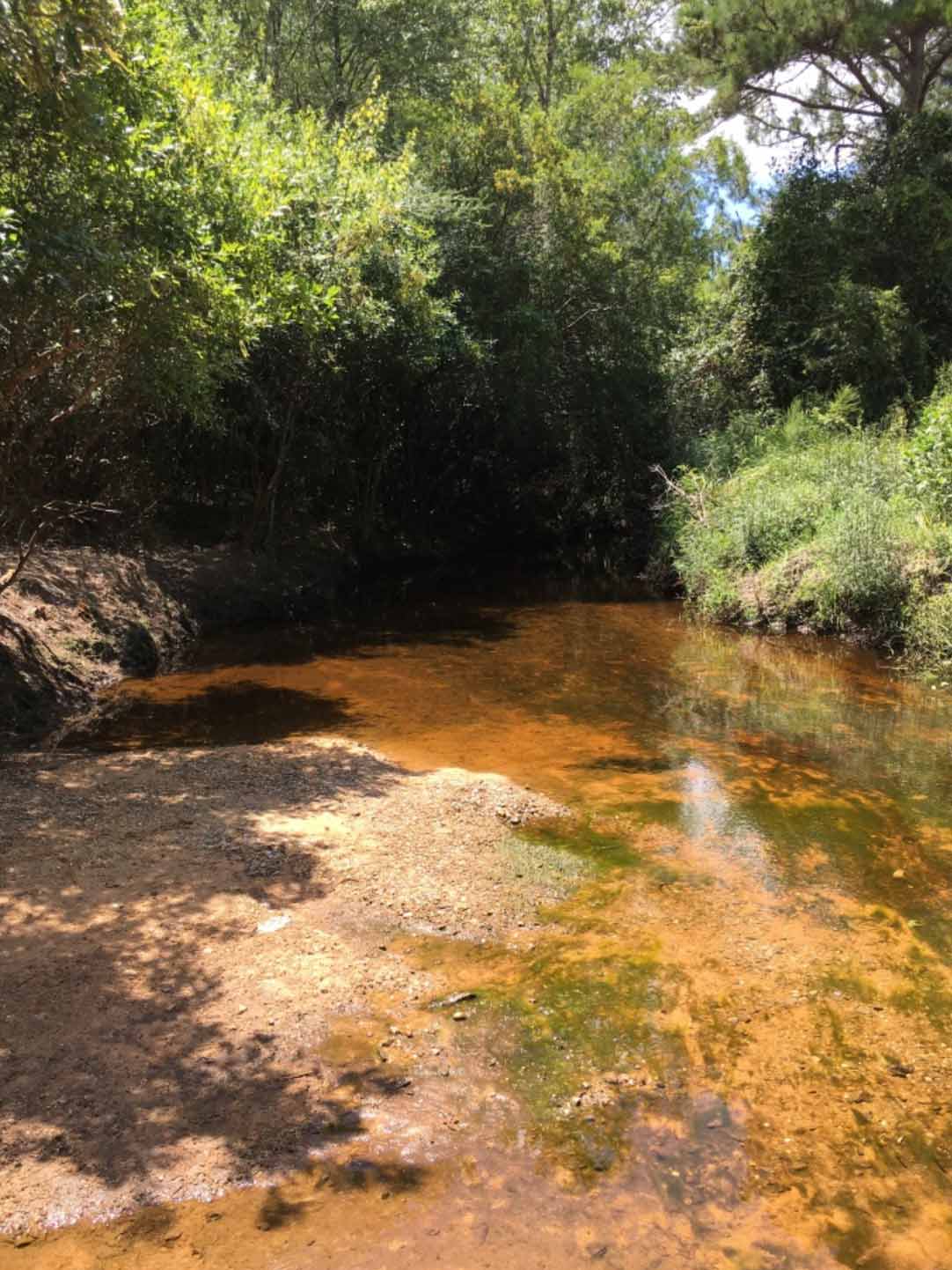
 Little Cedar Creek north of Beesley Road – downstream of the proposed dam on Little Cedar Creek, would be flooded by the Lower Lake on Big Cedar Creek Little Cedar Creek north of Beesley Road – downstream of the proposed dam on Little Cedar Creek, would be flooded by the Lower Lake on Big Cedar Creek |
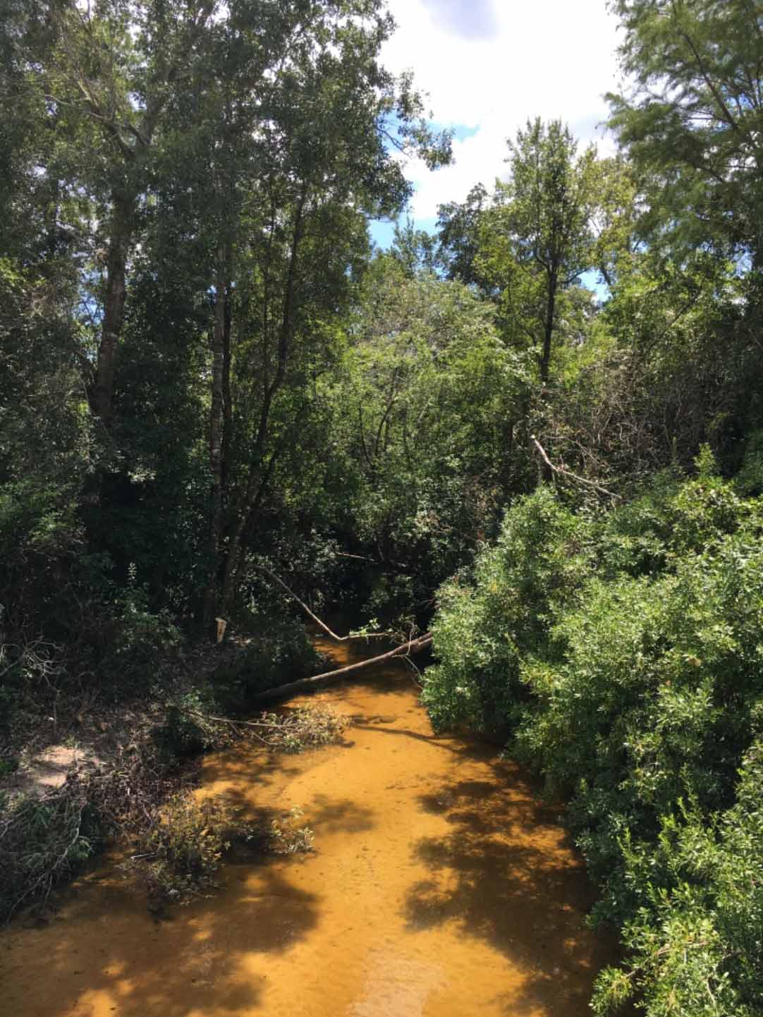 Little Cedar Creek south of Beesley Road – downstream of the proposed dam on Little Cedar Creek, would be flooded by the Lower Lake on Big Cedar Creek. Little Cedar Creek south of Beesley Road – downstream of the proposed dam on Little Cedar Creek, would be flooded by the Lower Lake on Big Cedar Creek. |